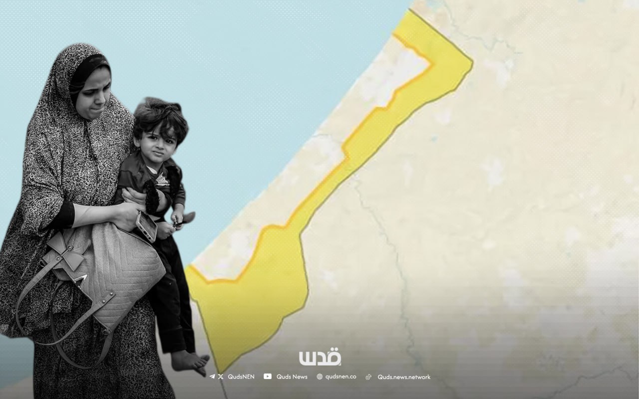
What Is the ‘Yellow Line’ Marked by Israel on Gaza Maps but Invisible to Palestinians
Gaza (QNN)- Since the ceasefire took effect in early October, Israeli forces have killed dozens of Palestinian civilians, justifying the killings by saying they were approaching the so-called “yellow line” ceasefire demarcation.
Gaza residents reported confusion over the line’s location because of a lack of a visible boundary.
Ahmed Ashour, a resident of Gaza City’s Tuffah neighborhood, told QNN: “We’ve seen the maps, but there are no clear markings on the ground. We can’t tell where the lines are supposed to be.”
What We Know
On October 10, the Israeli forces completed the first phase of withdrawal under the ceasefire deal to the “yellow line,” a non-physical demarcation line separating the Israeli occupation forces from certain areas of Gaza, while maintaining control over approximately 50% of the enclave.
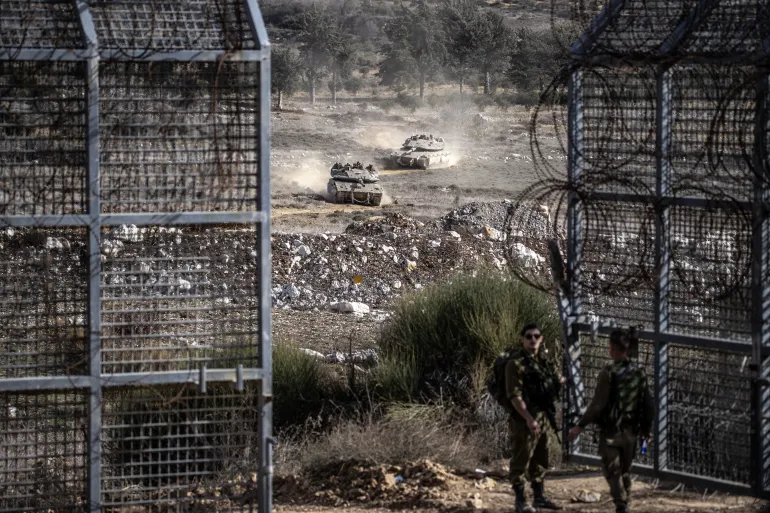
Israeli Defence Minister Israel Katz said anyone remaining beyond the yellow line would be targeted without warning.
According to an Israeli map presented under US President Donald Trump’s 20-point Gaza ceasefire plan, the yellow line extends from south of northern Gaza down to the outskirts of Rafah in the southern Gaza Strip.
Israeli forces remain deployed in the Shejaiya neighborhood, parts of the Tuffah and Zeitoun in Gaza City, as well as in Beit Hanoun and Beit Lahiya in the north, Rafah in the south, and along the Gaza coast.
The Israeli forces directly open fire on any Palestinians crossing this “yellow line” or even approaching, without prior warning.
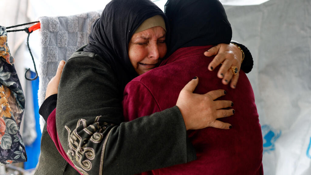
Palestinians returning to their destroyed homes amid the ceasefire have been attacked by the Israeli forces near the line.
The Israeli military said it has started placing yellow concrete blocks to mark the imaginary boundary, a line that separates between life and death.
According to the IDF Spokesperson, “The marking is being carried out on concrete barriers topped with a yellow-painted post standing 3.5 meters (11.5 feet) above the ground,” adding that concrete barriers are “being placed every 200 meters.”
On Friday, in the deadliest single violation of the ceasefire, an Israeli tank shell was fired by Israeli forces at a civilian vehicle carrying the Abu Shaaban family in the Zeitoun neighbourhood in Gaza City, according to Gaza’s civil defense. Seven children and three women were among those killed when the Israeli military fired on the vehicle as the family attempted to reach their home to inspect it after unknowingly crossing the yellow line.
“What happened confirms that the occupation is still thirsty for blood, and insists on committing crimes against innocent civilians,” civil defense spokesperson Mahmoud Basal said in a statement.
Since the ceasefire came into effect, Israel has violated the truce at least 80 times, said the Gaza Government Media Office, killing 97 people and injuring 230 others.
The violations included crimes of direct gunfire against civilians, deliberate shelling and targeting, and the arrest of a number of civilians, reflecting the occupation’s continued policy of aggression despite the declared end of the war, said the Office.
Ashour said, “Gaza residents are living in constant fear and confusion, even our homes are no longer safe. A single line separates life from death, and shelter from risk."
Following the announcement of Trump's plan, many questions remain for Palestinians regarding how the plan will be implemented, the exact boundaries of Palestinian territory, and the timing and scope of Israeli withdrawals.
Rania A., an academic at Al-Aqsa University in Gaza, said that Palestinians’ lives are constantly shaped by Israeli-imposed lines, even within their own homeland.
“The international community and world leaders facilitate the existence of these lines, enabling Israel to occupy and expand its control under false agreements aimed solely at the ethnic cleansing of Palestine since 1948.”
Israel, described as a country without borders, has created several lines since its establishment, including:
The Green Line: a line formed in 1949 for the border between Israel and what was left of historic Palestine. It came as a result of the armistice agreements signed by Israel, Jordan, Egypt, and other Arab states after the 1948 war. The armistice line was marked on the map with a green pencil (hence the name Green Line).
The Blue Line: it was established in 2000 by the UN after Israel withdrew from southern Lebanon to confirm Israeli withdrawal, not an official border.